ArcGIS GeoAnalytics Server for Big Data: Detect Patterns & Trends …
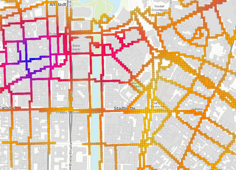
infas 360 is specialized in handling huge spatial data sources. One of These e.g. is mobile data. In the map above you can see a raster data hot spot analyses of pedestrians in the city of Düsseldorf, Germany.
As the data is growing enormously (you can also say dramatically if you still have the claim to be the master of data processing & analyses) infas 360 is now focussing on Big Geoata Technology. ArcGIS GeoAnalytics Server by ESRI provides all the functions & capabilities we had looked for.
We are analyzing billions of points in order to find consumer heat maps. The so called hot spots are mapped to the infas 360 Lifes Mobility Circle that identifies workplaces, homes, leisures, health & finance places and Aggregate this into consumer segements. In the next step dynamic data will be matched to the segements in order to generate a Customer Real-Time Segmentation (CURTIS).
For more Information about ArcGIS GeoAnalytics Server see this video
or contact our Consulting-Team Consulting@infas360.de